Note: As an Amazon Associate, I earn from qualifying purchases at no cost to you.
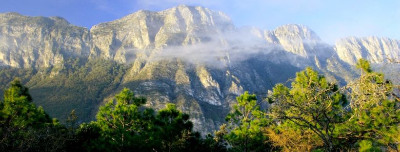
Monterrey, Mexico is one of the best places in northern Mexico for hiking as it sits along the Sierra Madre Oriental Range. Translated, Monterrey means “king of mountains” which is aptly suited. While Monterrey is a modern city, it has plenty to offer any nature lover. Here are the most popular hiking locations and trails in Monterrey.
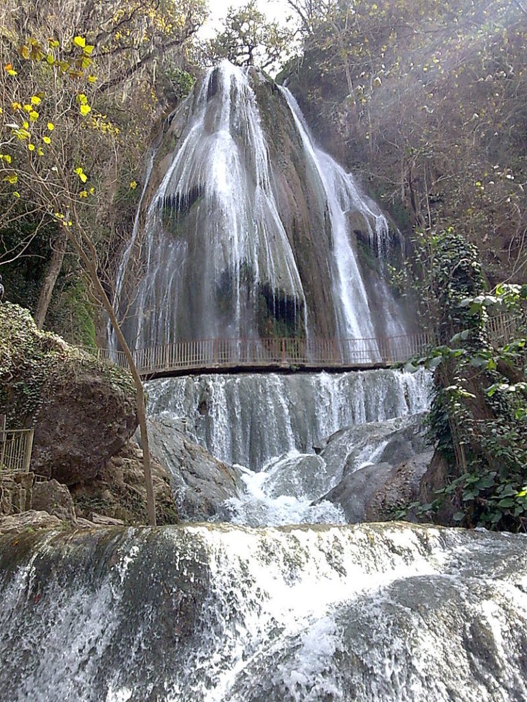
Hiking to Cola de Caballo
Let’s start our hiking adventure with the most popular spot near Monterrey. Translated to horse’s tail (or ponytail) Cola de Caballo is popular with locals and tourists because of its scenic waterfall. It is about 28 miles outside of central Monterrey. I would allow about 50 minutes to an hour to get there by car and be sure to go early because as I stated, this is a popular spot.
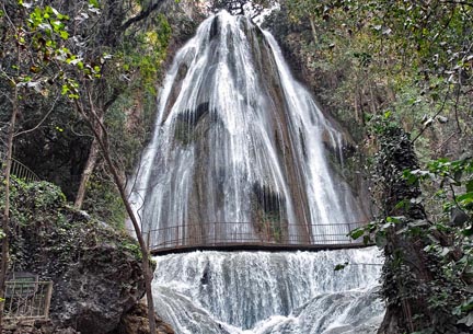
The hike to the waterfall isn’t long and there is an option for horseback riding although this is probably best for just the kids. Even if it’s a relatively short hike, you can still make a day of it. Pack a picnic. There are grills and benches available and you can spend the day enjoying your lunch in the
However, according to some reviews, if you go during the dry season, you probably won’t be too impressed. But I have always been lucky enough to go when it was a nice full waterfall, so I enjoyed the experience without a doubt.
Hours: Daily 9am-6pm
Cost: 40 pesos per person (at 17 pesos per dollar in March 2019, that’s about $2.35)
Where to Go: Carr. a la Cola de Caballo KM 6, El Cercado, 67320 Santiago, N.L., Mexico
Tips: They have a free parking lot, but some people choose to pay a small fee to park in the neighboring hotel parking lot. Because of the wet conditions, I usually wear moisture wicking shirts like these. They are perfect for the conditions.
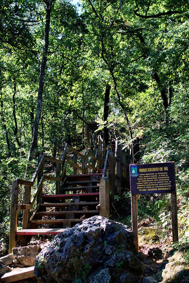
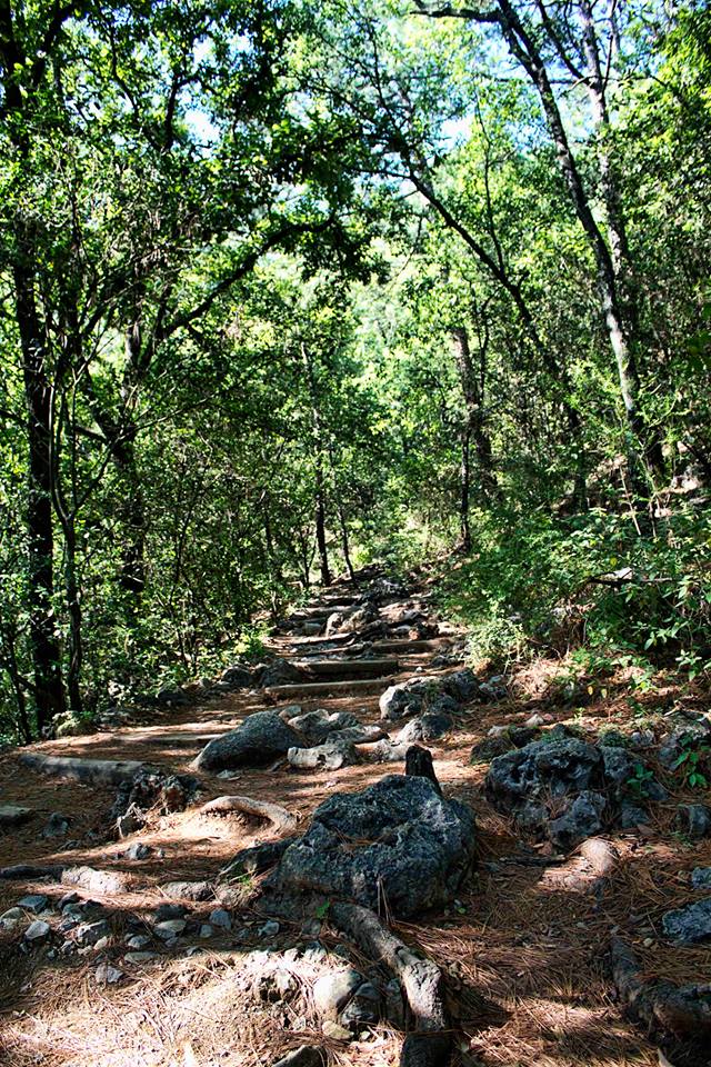
Hiking in Parque Ecológico Chipinque
Parque Ecologico Chipinque is a national park about 20 minutes from the Monterrey’s city center and one of my favorite national parks in Mexico. The park offers many different activities including bird watching, mountain biking, use of outdoor gym equipment, and of course, hiking.
There are many opportunities for hiking through the forests and lower elevations. This is considered the first part of the hike. Many of the paths are easy to walk (easy is relative as this is still uphill hiking), and some paths have some man-made steps and stairs to guide you. The second part of the hike is definitely more difficult and you probably shouldn’t go with someone who will just complain about being tired after a little while. Even so, there are areas for rest along the way that provide seating and vending machines.
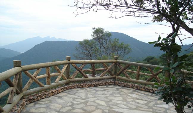
Lookout Point
Hiking to the summits, though, is another thing. If you want to hike to the summits, you need permission from the park at least two days in advance for weekday hikes and 15 days in advance for weekend hikes. They have a couple of rules including these two important ones to note. 1. You cannot hike to the summits alone. The permit you receive is for 2-5 people. 2. You must begin hiking between 6 and 8 am.

Rosalba Macías, paramedic and ranger @ Chipinque

Hours: 6am-8pm
Cost: 20 pesos (about $1.30) per person on foot; 150 pesos (about $7.80) per car
Where to Go: Carretera a Chipinque Km. 2.5, Valle de San Angel, 66261 San Pedro Garza García, N.L.
Tips: As usual, bring plenty of water and wear comfortable hiking clothes.
http://www.chipinque.org.mx/
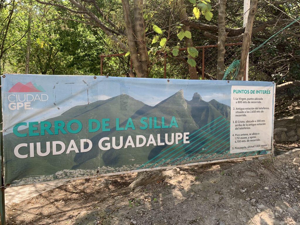
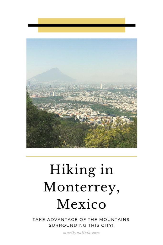
Hiking Cerro de la Silla
Technically located in neighboring Guadalupe, Cerro de la Silla is a 15-minute drive from Centro Monterrey. Cerro de la Silla is the symbol of Monterrey due to the unique shape of its peak- it almost looks like a chair you can sit in.
There are four main peaks of interest to stop at while hiking. Starting from the lowest the peaks are- Pico la Virgen, Pico Antena, Pico Sur, and Pico Norte. The climb to the top is 3.3 miles. I’m in decent shape. I could hike 3.3 miles, but I cannot UPHILL hike for that long. So my plan was to make it to Pico Antena because they have a large lookout area that is popular for picture taking and taking in the city views. But I was dumb. I was ill prepared with only one water bottle in my bag and an alcoholic beverage in my system from brunch. I know. Dumb. But I completely underestimated my abilities and the rigor of the trail. So if you’re planning on making it to the top, don’t be dumb like me. Pack plenty of water, wear appropriate
I considered paying for a guided hike through AirBnB experiences, but I’m glad I just decided to figure it out naturally (even if I almost died, kind of). But here are some things to note. There is no park ranger or entrance kiosk. You don’t check in anywhere or get a trail map from anyone. You are on your own. If you’re looking to break an ankle, this is the spot to do it. I’m kidding. Don’t. Because you’ll be sitting up there with a broken ankle for a while waiting for help to arrive. If you have to walk up large, uneven rocky terrain slowly, so do rescue teams. But I seriously can’t wait to go back to Cerro de la Silla and do it right next time. Pico Norte, I’m coming for you. And with this awesome new hydration pack I just got.
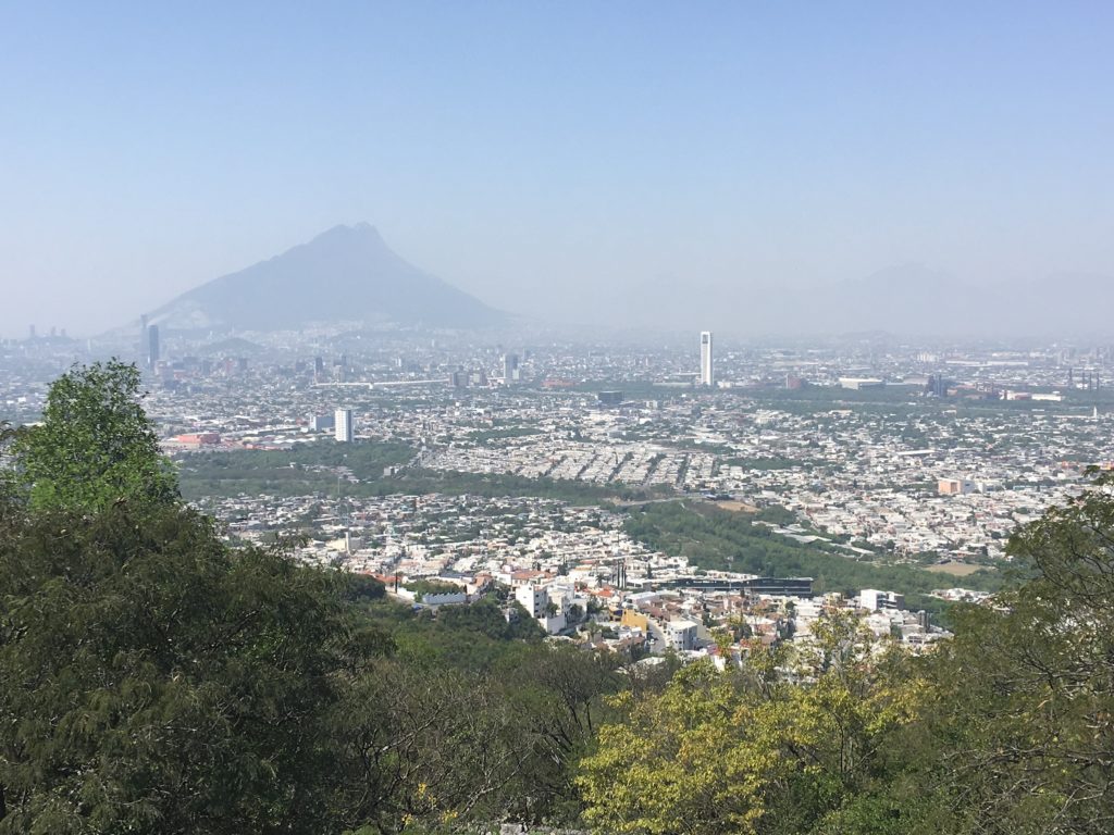
Views Along the Hike 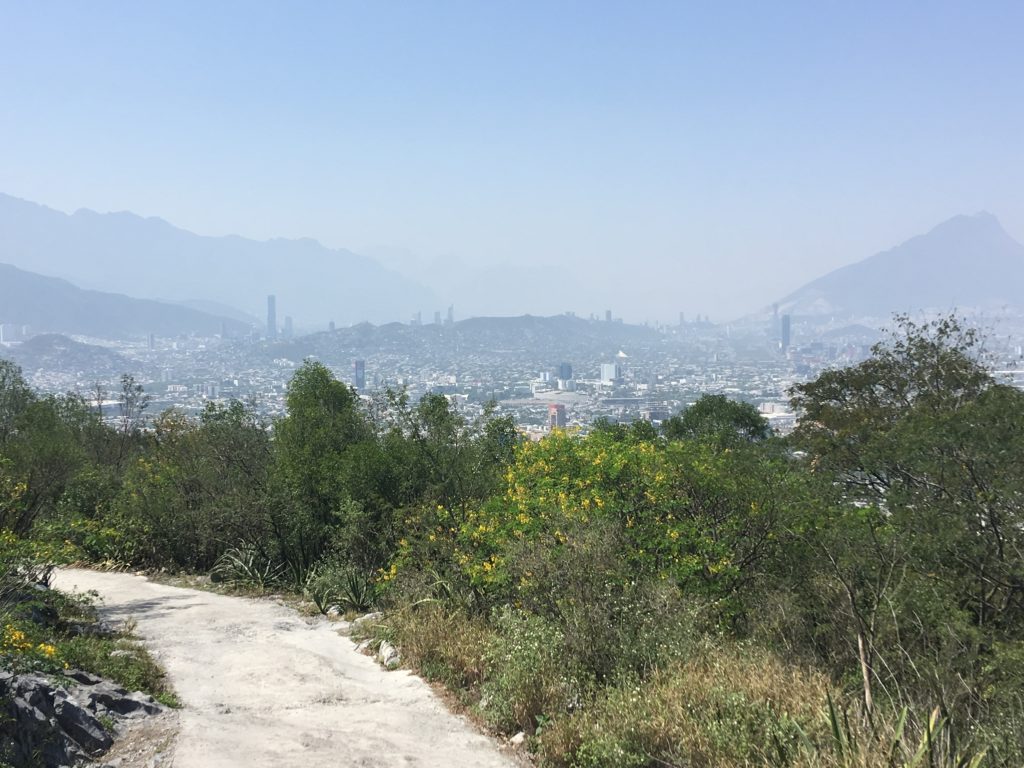
Great Cityscape, Rocky Trail
Hours: 24 Hours (but be smart, no nighttime hiking)
Cost: Free Where to Go: Calle Bosques de La Pastora, Guadalupe, N.L., Mexico
Tips: There is no designated parking lot, only street parking. Street parking is free but make sure to pay attention to parking signs. Taking an Uber or taxi is always a good bet.
Hey thanks for the info. I’m heading there this week and was really struggling understanding parking. Thanks for clarifying that! Parking, places to stay overnight, cost, and logistics are just as important as the trail.
Cerro del Mirador is a 7.6 kilometer moderately trafficked out and back trail located near Monterrey, Nuevo Leon, Mexico that offers scenic views and is rated as moderate.
Lot of good material here keep up the good work